
Maps Gallery
The maps gallery contains a collection of maps that were instrumental in reconstructing the landscape of 1862. Maps include hand-drawn soldier's maps as well as official survey maps from 1890.
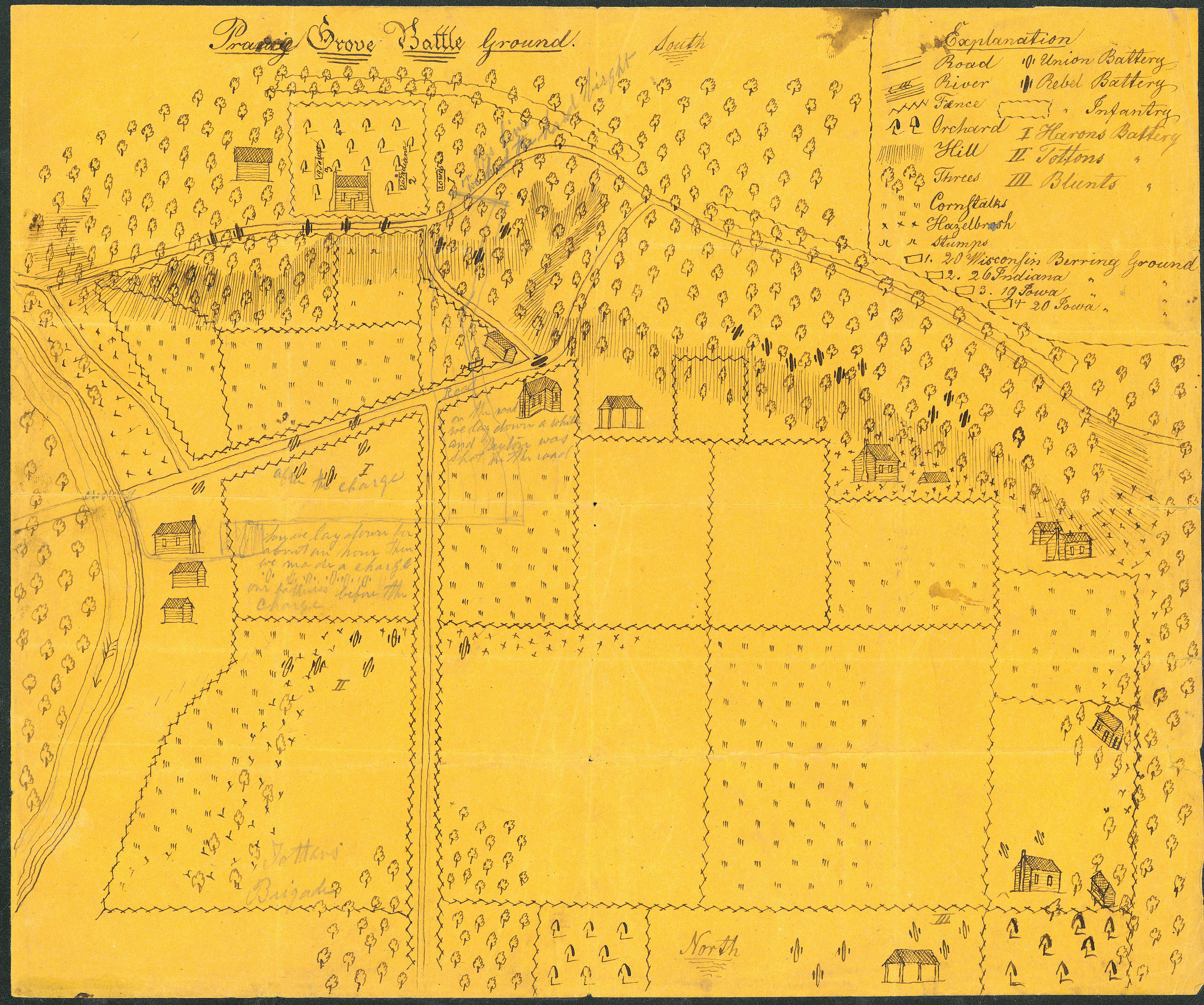
A hand-drawn map by D.B. Arthur, a Union soldier in the 20th Wisconsin Infantry, this map wonderfully depicts details of the landscape including vegetation coverage and structure locations as well as the position of the Union and Confederate troops.
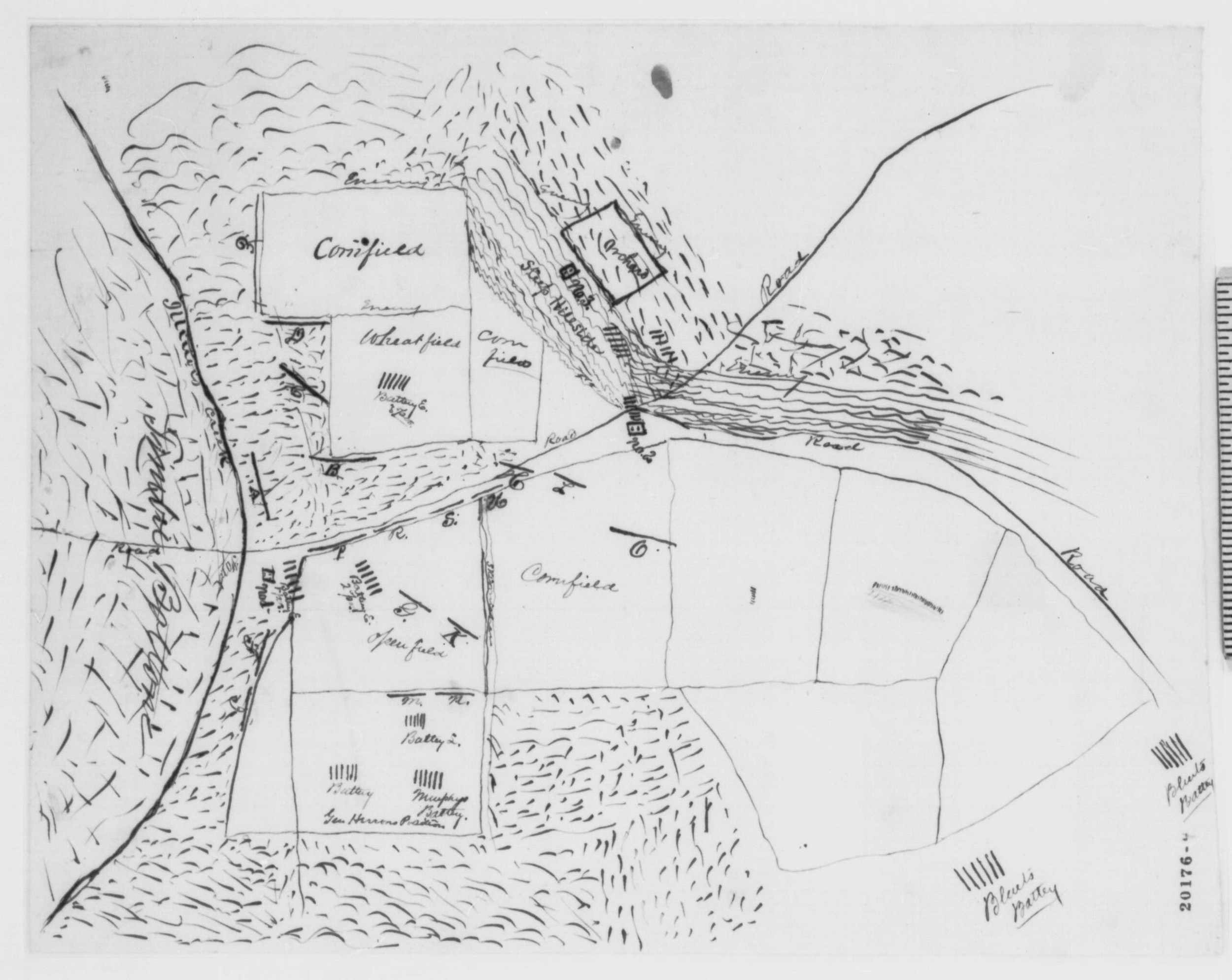
A hand drawn map drawn by soldier Hudson Burr of the 94th Illinois Infantry.
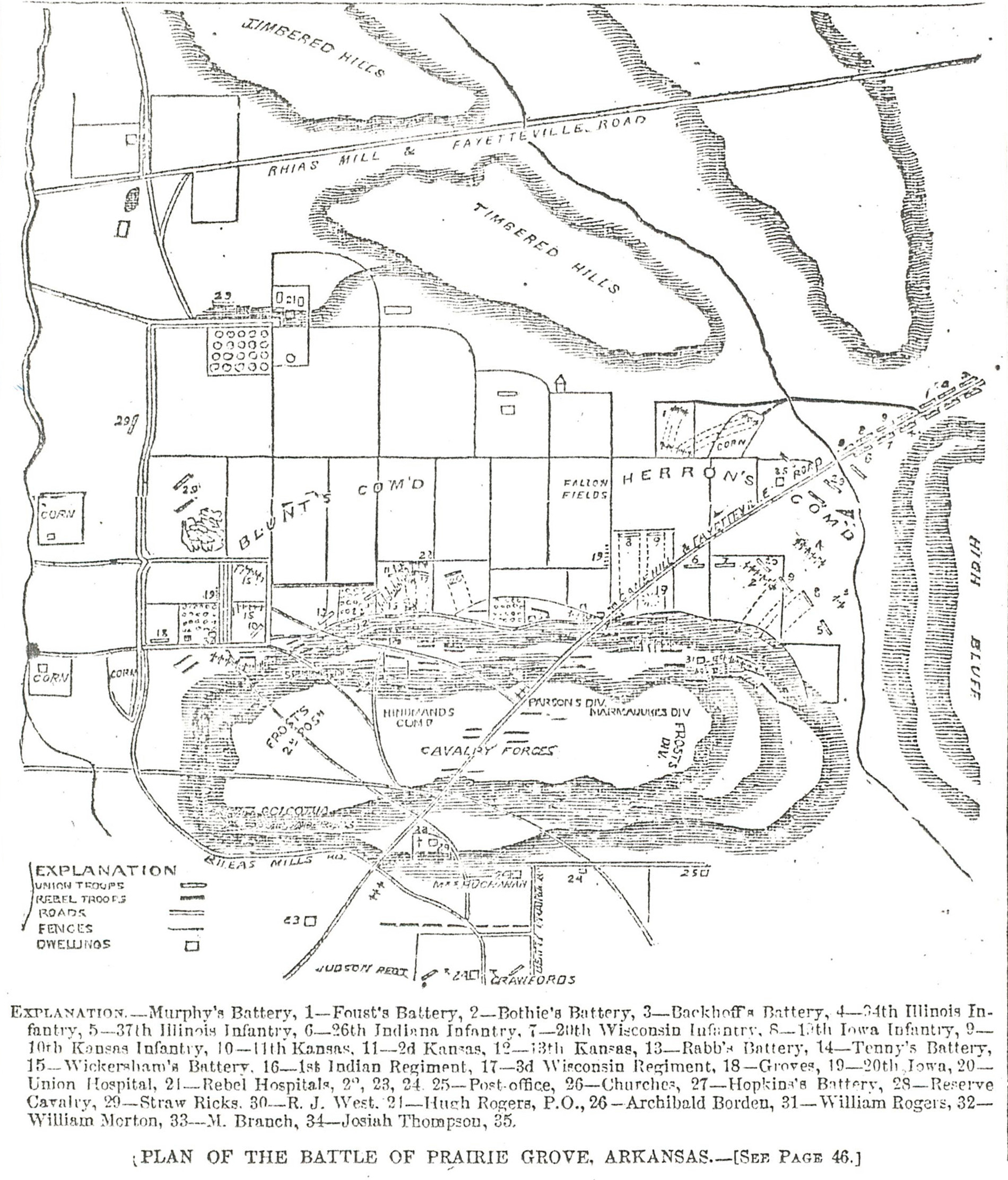
This map of the battlefield area was printed in a newspaper, Harper's Weekly, over a month after the battle on January 17, 1863.

Created by Arkansas Parks and Tourism, this map was used to determine the placement of features within the landscape in the immediate battle area. The location of fields, forests, roads, rivers, orchards, houses, and other structures were extracted from this map and used in the creation of the 3D landscape.
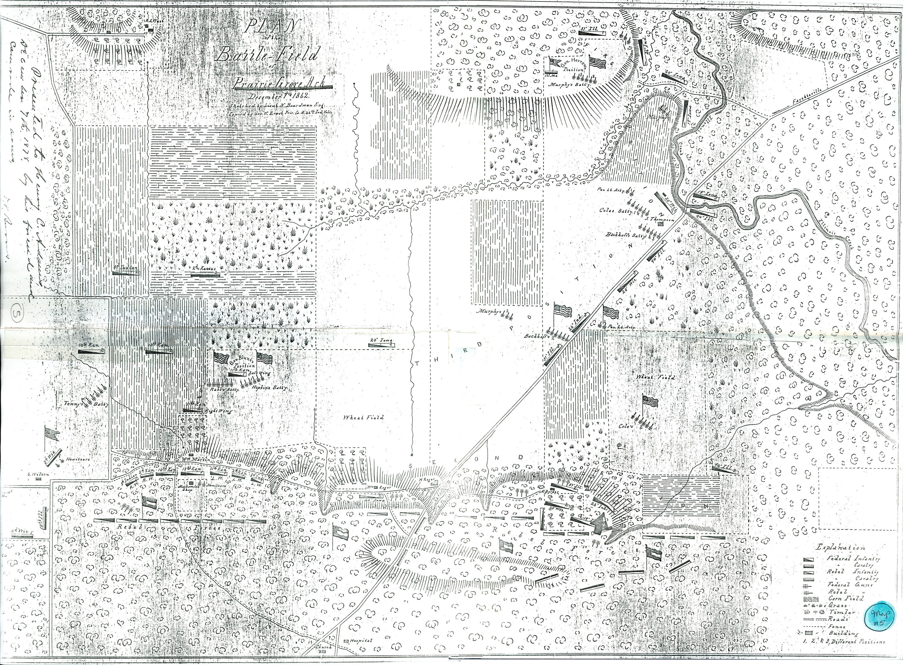
A hand drawn map by Lieutenant N. Boardman, an engineer in the Union Army. This map show numerous details of the battle within the context of the surrounding landscape.
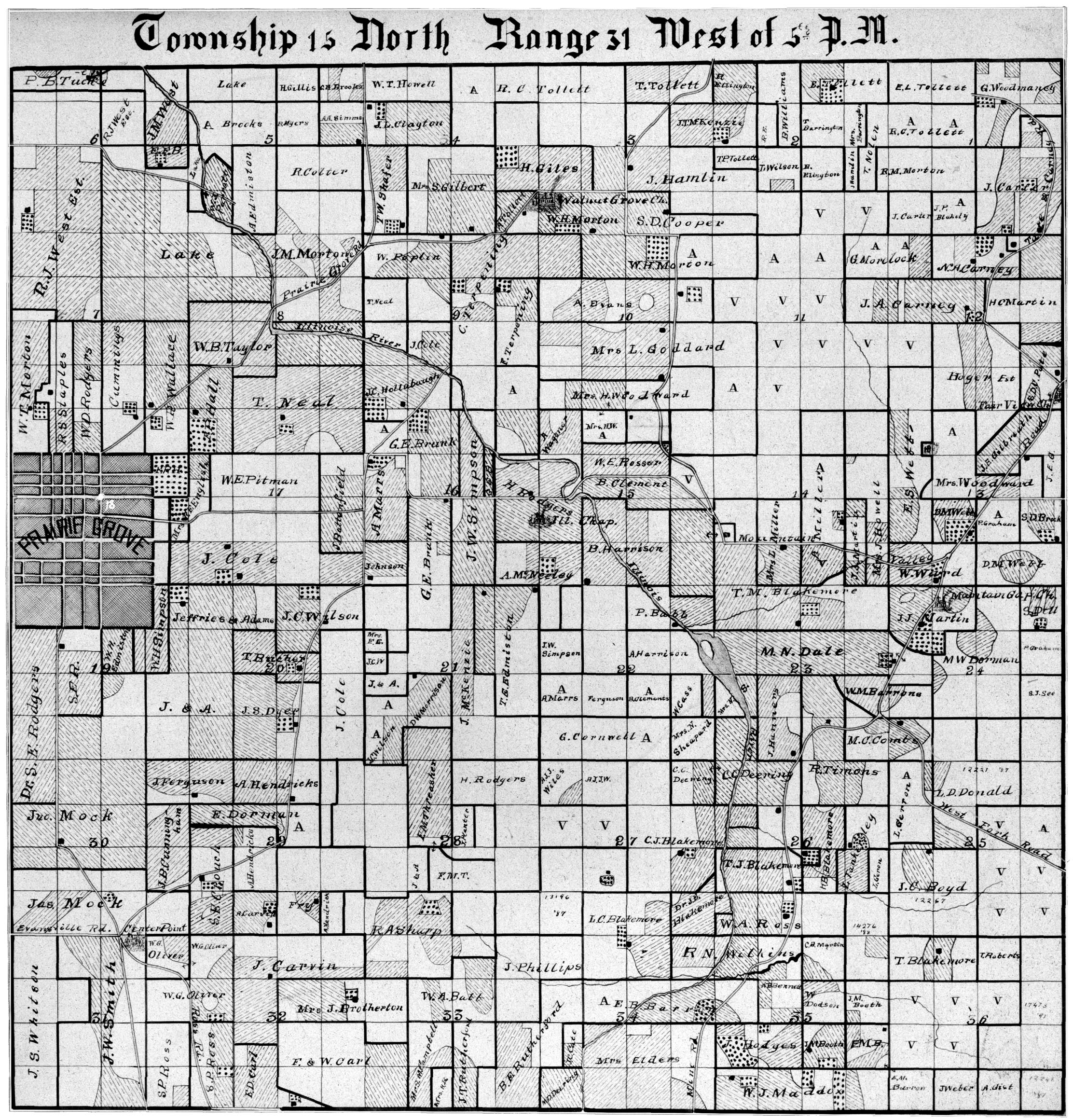
These parcel maps are from the first detailed map survey of Washington County, Arkansas, published in 1894 and created by Gordon V. Skelton. Four of thes maps were stitched together and used to create the regional landscape outside of the immediate battle area.